


Economisez 20%
Blackweek
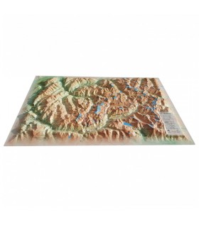
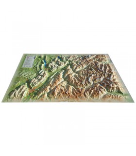
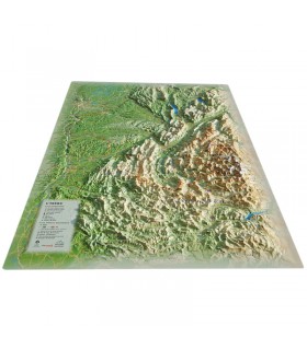
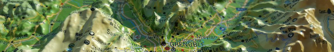
Fly over Lake Annecy with this relief map from the brand 3DMap. With exceptional accuracy, it faithfully recreates the terrain and contours of this stunning region.
Dimensions (cm): 41 x 61
Planimetric scale: 1 / 60,000
Altimetric scale: 1 / 60,000
Option to add a frame
The Lake Annecy relief map showcases this incredible region from a unique perspective. It offers a detailed view of the lake, and the mountains of Savoie and Haute-Savoie. You will find, for example, paragliding sites, ski resorts, Via Ferrata routes, as well as many other details such as:
The 3DMap brand maps allow you to explore a region or a mountain range in a simple and unique way. The 3D reliefs featured on these maps are extremely useful for visualising and understanding the topography of the area. In addition, the many pieces of information they provide make it possible to study hiking routes as well as numerous other activities depending on each person’s interests (via ferrata, paragliding, sightseeing, etc.).
Moreover, these 3D relief maps can also serve as decoration. Paired with a beautiful wooden frame, they can enhance and embellish a wall or an office. You can even add pins and thread to display your hiking routes or your most memorable paragliding flights to your guests or visitors.
Data sheet
 Garanties sécurité
(à modifier dans le module "Réassurance")
 Politique de livraison
(à modifier dans le module "Réassurance")
 Politique retours
(à modifier dans le module "Réassurance")


Fly over Lake Annecy with this relief map from the brand 3DMap. With exceptional accuracy, it faithfully recreates the terrain and contours of this stunning region.
Dimensions (cm): 41 x 61
Planimetric scale: 1 / 60,000
Altimetric scale: 1 / 60,000
Option to add a frame